A land surveyor uses instruments to make precise measurements of the earth�s surface. From determining property boundaries to preparing construction sites, surveyors rely on certain equipment to do their jobs properly.
Below is a summary of eight different types of
surveying equipment and their uses:
1. Chains and Tapes
Taking accurate measurements is one of the most important tasks a land surveyor must complete. There is a variety of tools that can be used to take measurements including tapes, rulers, chains, and laser devices. Pocket tapes are ideal for small-scale measurements while measuring wheels, nylon coated steel tapes (Nyclad tapes), and fiberglass tape measures can be used for larger distances.
Recommended Products in this Category:
- Nyclad Tape Measures � Ideal for jobs requiring accurate measurements in harsh climates or inclement weather, nylon-coated steel tapes offer a flexible and durable option with the added benefit of an expansion coefficient similar to that of a steel drag chain.
- Fiberglass Tape Measures � Available in a variety of lengths, fiberglass tape measures are plastic-coated for durability but remain lightweight enough for easy portability and are less likely to kink the way a steel tape can.
- Measuring Wheels � Also known as a surveyor�s wheel, measuring wheels feature a rotating wheel that measures the distance between two points while walking and is best suited for inspection or estimation work.
- Laser Measuring Devices � For the ultimate in precise measurement, laser technology is capable of measuring inclination, slope distance, and azimuth, in addition to making both vertical and horizontal calculations.
View Laser Technology, Inc. products for utilities inspection and forestry work.
2. Compasses and Clinometers
A compass is an essential piece of equipment when surveying in unfamiliar territory, backcountry, or just orienting your position on a map. Compasses can be used to measure distances between two points while clinometers are used to measure the angle or elevation of slopes.
Recommended Products in this Category:
- SILVA Ranger 2.0 Quad Compass � Ideal for measuring direction over long distances, this mirror-sighted compass features quadrant graduations and offers a high degree of accuracy, precision, and durability.
- Brunton Omni-Slope Sighting Clinometer � This clinometer features a precision pendulum for fast, accurate readings and is housed in lightweight aluminum for durability and portability.
- Brunton TruArc 20-Mirror Compass - A modern upgrade to a trusted classic, this mirror-righted compass features the TruArc global needle system for consistent polarity and reduced magnetic interference. It also features a map magnifier, an Ever-North magnet, and a magnified readout.
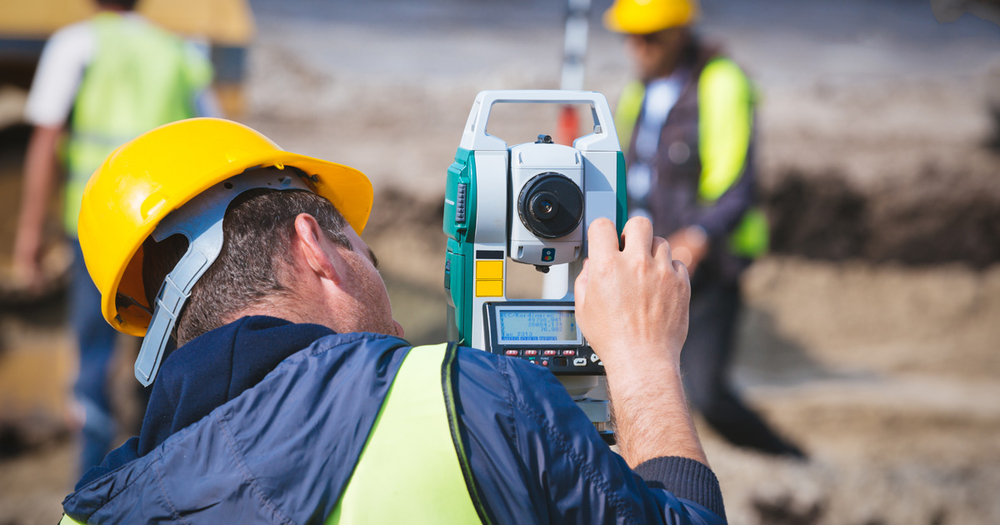
3. Transits and Theodolites
These tools are used to measure both horizontal and vertical angles. Both tools have a minimum accuracy of one minute of angle, though the theodolite is generally recognized as the more accurate of the two, measuring angles to an accuracy of one-tenth of a second angle.
Recommended Products in this Category:
- Brunton GEO Pocket Transit � Equipped with a rare-earth magnet and sapphire jewel bearing, this transit allows for quick, simultaneous trend and plunge measurements, as well as readable dip measurements.
- SECO Total Station and Theodolite Rucksack � This heavy-duty but lightweight pack was designed to securely carry surveying instruments like a total station or theodolite.
4. Levels
A level can be used to read an elevation and determine differences in elevation between two points. These tools can be handheld, optical or digital, and are typically used in conjunction with
level rods or tripods.
Recommended Products in this Category:
- Sokkia SDL50 Digital Level 28x � Offering easy, accurate measurements at the touch of a button, this digital level minimizes human error, combining user-friendly convenience with optimal functionality.
- SECO Hand Levels � For up-close work in even the roughest terrain, these hand levels feature lightweight but heavy-duty construction with both internal and replaceable external vial modules and 3-line mirrors to ensure a deviation of less than � inch per 20 feet.
- Spectra Precision Laser Level LL500 � Designed for long-range measurements across an entire site, this precision laser level features rugged construction, highly accurate readings, a self-leveling system, and built-in �out of level� shutoff.
5. Safety Gear
Land surveyors work in all kinds of conditions and climates, but safety is always the primary concern.
High-visibility gear and safety headwear are a must for all outdoor work crews.
Recommended Products in this Category:
- 3A Safety 3 Season Waterproof Thermal Jacket � Made with DUPONT-treated Teflon fabric, this waterproof jacket keeps you warm in even the harshest weather conditions while also offering maximum visibility.
- ML Kishigo Safari Hat � These full-brim hats offer 360-degree reflectivity while also keeping your head cool and well ventilated.
- SECO Class 2 Safety Utility Vest � Designed specifically for surveyors, this utility vest is made from durable ANSI/ISEA-compliant materials with a padded collar for comfort and multiple pockets for convenience.
6. Prisms and Reflectors
Prism systems are used to secure control points at a comfortable and accessible height for pinpoint accuracy. These devices can be mounted on surveying poles and used in conjunction with electronic distance measuring (EDM) instruments for improved accuracy.
Recommended Products in this Category:
- Sokkia Economy Tilting Prism � Available at an affordable price point, this tilting prism allows the user to quickly adjust the target from behind for accurate sighting.
- SECO Double Right Angle Prism � For compact size and precision, this double right-angle prism allows for easy determination of right-angle or perpendicular points between two targets.
- GeoMax GRZ122 360� High Accuracy Prism � This high-performance prism features a built-in point that allows the reflector to be positioned directly on the mark for pinpoint accuracy.
7. Magnetic Locators
When conducting a land survey, it is necessary to identify the location of certain features, such as manhole and utility covers, steel and iron pipes, underground tanks, and survey corner markers.
Magnetic locators can be used to quickly and precisely locate ferrous materials like iron, steel, and rebar.
Recommended Products in this Category:
- Schonstedt Maggie Magnetic Locator � This �next generation� magnetic locator offers single-handed operation, maximum sensitivity, precision, and state-of-the-art ergonomics for comfortable use.
- ChrisNik HoundDog Magnetic Locator � With integrated Fence Ignoring Technology (FIT), this magnetic locator can sniff out hard-to-find survey markers even in the presence of metal fences and metal buildings.
- SubSurface Instruments Magnetic Locator � This combo kit includes both pipe & cable and magnetic locating, making it the perfect kit for utility-locating professionals in all industries, from gas to sewer, electric, water, and telecom.
8. Poles, Tripods, and Mounts
Even the most precise of surveying instruments can be thrown off by an unstable mount. Poles, tripods, and other mounting accessories are essential for surveyors to ensure solid, stable readings. These mounts can be used for all kinds of surveying equipment, including prisms, lasers, and levels.
Recommended Products in this Category:
- SECO Quick Release 8ft Robotics Pole � Made from heavy-duty carbon fiber, this robotics pole offers an anti-rotation quick release feature and easy push-button operation.
- SECO Tri-Max Dual Lock Tripod � Offering a combination of dual locks, quick release, and twist lock features, this surveying-grade tripod delivers certified accuracy and unmatched stability.
- Dutch Hill Heavy-Duty Column Clamp for Instruments � This lightweight aluminum clamp features a standard 5/8-11 mounting stud with a 6-inch mounting plate for use with a wide variety of surveying instruments & laser levels.
When it comes to land surveying, having the right equipment is essential. Whether you are measuring angles, distances, or elevations, having the best tool for the job will ensure speedy and accurate measurements for every application.
From determining property boundaries to preparing construction sites, surveyors must rely on equipment to do their jobs properly. Here, we cover eight types.